More spectacular scenery before turning homeward
And so we had come to the penultimate day of our west coast tour during which we would reach its northernmost point, the Gulf of Morbihan. Our original goal was to fly the length of the coast from the Aquitaine to Brittany, which we would achieve today, and although we had not succeeded in getting as far south as we’d hoped into the Pyrénées Atlantiques, we had made it as far as the Landes, which was not far off. But there was nothing to stop us reaching our northernmost goal in Brittany today.
The night before, the ULM club at St Brevin had kindly offered us the use of its clubhouse. This was very welcome, because although we were happy sleeping in our tents, it was nice to be able to cook our evening meal indoors (on the club meeting-room’s table!) and have a good wash for a change. The President had left us with the clubhouse key and just asked for it to be popped into the postbox before we left, which I did.
The total planned flying time for the day was 2 hours 50 minutes, in two legs, the first from St Brevin to a small privately owned airfield in the Loire Atlantique called La Bochet, and the second to an ULM airfield in the Vendée named Mouchamps. Here’s a shot of the route.

I’d really been looking forward to today because on the climb out from St Brevin, we’d be passing almost immediately over the striking road bridge that carries the D213 over the mouth of the River Loire from St Brevin to St Nazaire. After a 5 kilometre water crossing we’d then be passing over St Nazaire itself and continuing on northwards past La Baule.
Here’s a shot that I took as I coasted in over St Nazaire.

From now on I’ll just let the pictures that I shot as I flew up the coast, which are of really stunning scenery, speak for themselves. Before each shot I’ve shown where each one was taken so if readers want to they can cross-refer to Google Earth to see the exact locations for themselves.
So, next Pornichet, just past St Nazaire.


Then the airfield La Boule Escoublac. Unfortunately, because at the time I was over the bay and La Baule was on the other side of 56NE, I couldn’t take a shot of the town itself.

Then Le Pouliguen, a lovely little resort on the other side of the bay which was a water crossing of 6 km.


Then Batz sur Mer.

Then la Pointe du Croisic, one of the prettiest parts of the area that is called la Côte Sauvage.


Le Croisic and the thin spit of land opposite it enclose quite a large body of water. The thin spit is called la Pointe de Pen Bron

Next up is the resort called la Turballe.

Then Piriac sur Mer, just off to the west of my track.

Then, across the bay, a water crossing of 7 km, la Pointe du Bile leading onto Kerandré.

Then another water crossing to Kervoyal, with the Morbihan visible in the far distance.


Then on to Damgan.


Damgan Port is situated out on the peninsula a short distance away from Damgan the town.

Then over the next inlet to Pen Cadenic.

And then on to Kermor.

And then a surprise. Apart from planning the flight, I’d done no real research of the areas that we’d be flying through, and so you can imagine my surprise when off to the left of my track, I saw a large lake with an impressive mediaeval castle on it. It turned out that this was Suscinio, which is worth googling to read more about in its own right.

By now the Morbihan was coming ever closer, but first there was the little town of Saizeau.

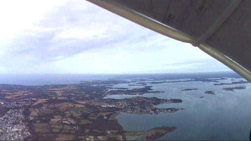
I then took a shot of the view of the Morbihan that lay before me through 56NE’s windscreen.

Continuing on, I then took a shot of Kerguillo which showed that off to the north beyond where we would be flying to, there was a huge bank of cloud or sea fog blanketing the seaboard. This was of interest as it showed that if we had been given permission to continue our flight through Lorient controlled airspace as we’d originally intended, it’s likely that we’d have found it impossible to do so!

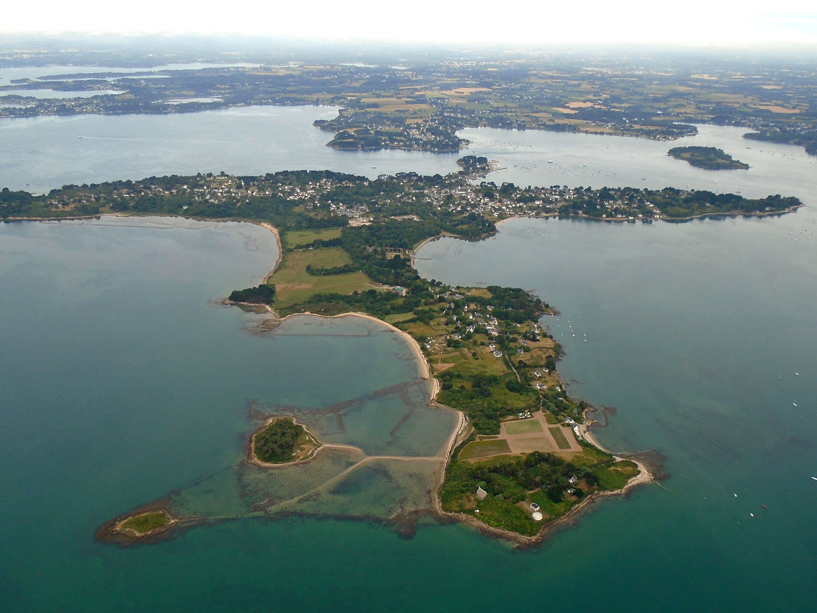
Here’s another general shot that shows off the character of the Morbihan to its best. Pity that by now the weather was becoming rather duller.

So there I was almost at the planned northernmost point of our tour, on the southern side of the Golfe du Morbihan. Now it was time to turn right for a 8 km crossing of the Golfe itself before turning right again on the other side to start heading homeward.
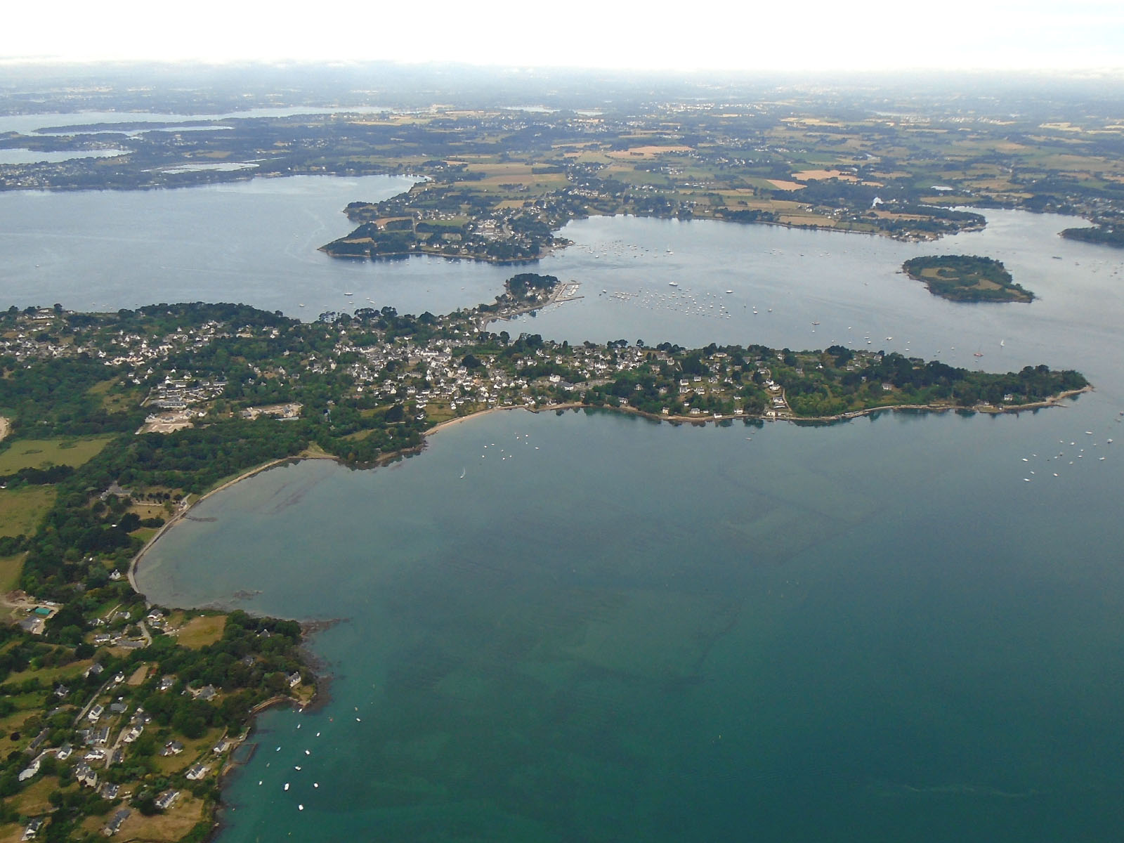
Here are some shots that I took of the Île au Moines as I did so.


Then finally a shot of the small waterside resort of Gréo on the northern side of the Golfe before making that right turn.

But the sights were far from over because shortly after turning and starting to head south-east, I passed the city of Vannes, off my track to the left.


I was quite surprised by how large a place Vannes is, and shortly afterwards, in contrast, I flew past the pretty little waterside commune of Noyalo.

I was already beginning to think about my landing at La Bochet which would be coming up in a few minutes time, but first I took one more shot of the watery Morbihan countryside.

It wasn’t difficult finding the airfield at La Bochet with its long, wide runway and adjacent distinctively situated small wood. After I’d landed, I found that Wim had got there before me.

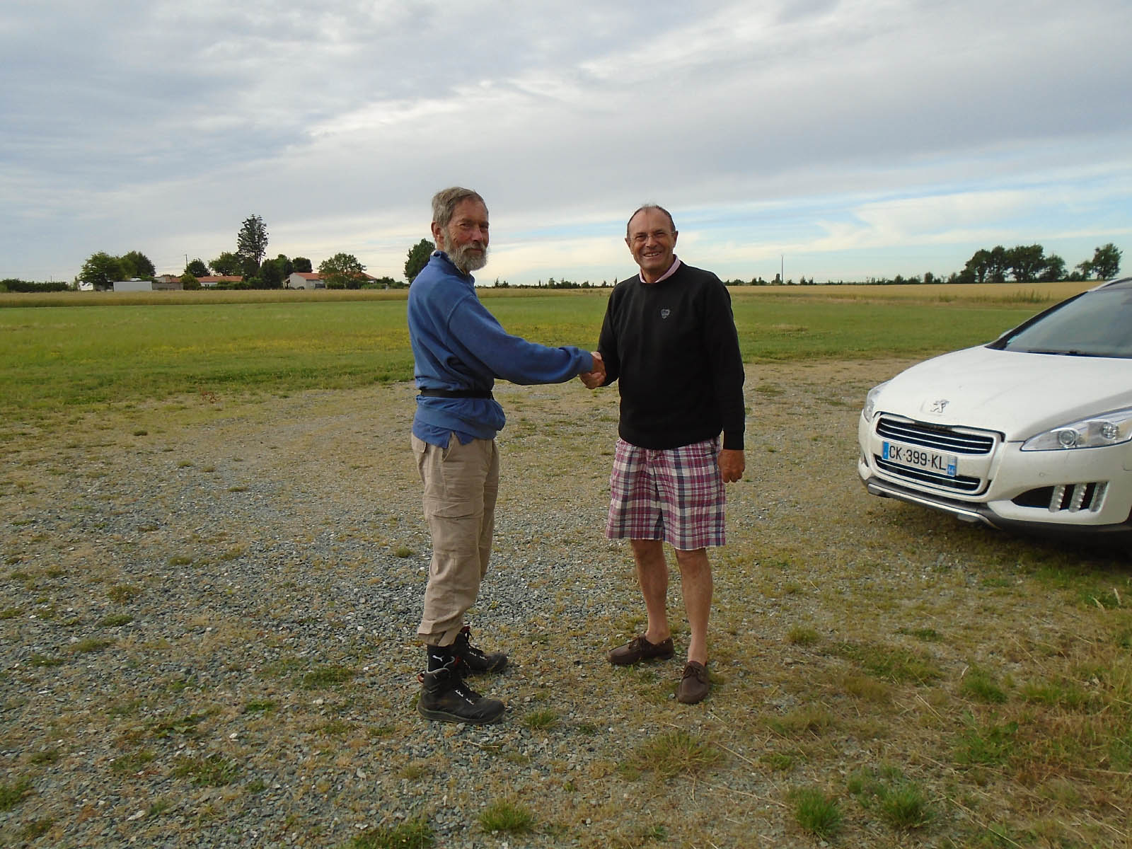
Here’s a shot of Wim with the owner, M. Gautier, who kindly took Wim to buy some fuel. It turned out that not only does M. Gautier not own an aircraft himself (the main user of his airfield is a friend of his who owns a Mooney and who also turned up to meet us a bit later) but he also incurred a round-trip of 35 kms from his home to come and help us out, which Wim and I thought was an amazingly kind gesture.

My planned flying time from St Brevin to La Bochet, 1 hour 39 minutes, actual time 1 hour 35.
M. Gautier offered us sandwiches that he’d brought with him, which we declined as we really wanted to get off again on the second leg of our day’s flight, but we did accept his offer of a cold drink each. Even so, we ended up being there for not far short of two hours, once we’d had our drinks and a chat and sorted out our fuel. Then we were off to Mouchamps in the Vendée.
By now after the awesome scenery of the Morbihan, I wasn’t quite so interested in taking photographs but did manage a few along the way. First, the commune of Bouvron.

From there, it wasn’t long before I’d be coming up on the city of Nantes and before I did so, I took one last pic of the open Loire Atlantique countryside.

Then I flew around to the north and east of Nantes itself. As the second pic shows, I found it a bit more built-up than the chart had suggested and although I wasn’t concerned that 56NE’s engine might fail, I was glad to eventually put the city and its suburbs behind me.


Some minutes later I entered the Vendée on my way to Mouchamps and just before arriving there, I came across this enormous open-work quarry.

A few minutes later I was searching for the airfield and finding it rather hard to spot. On my second circuit of the area, I was pleased to spot the Red Baron already on the ground and parked close to a windsock and large hangar, so it was then just a matter of landing and joining Wim.
My planned flight time from La Bochet to Mouchamps, 1 hour 10 minutes, actual time 1 hour 15. Here’s a shot of Wim with the owner, M. Guerton.
And so we’d come to the end of a memorable penultimate day of our west coast flight. It had been dull for much of the flight but the scenery had been stunning for almost the whole way and I’d not have missed it for anything. Now it was time to park our aircraft, put up our tents and enjoy a well-deserved evening meal of ravioli.
I shot a video of the day which can be viewed by clicking on the image below.