Was everything that I’d hoped it would be. There were a couple of minor disappointments, which I’ll come onto later, but on the whole it lived up fully to my expectations for it.
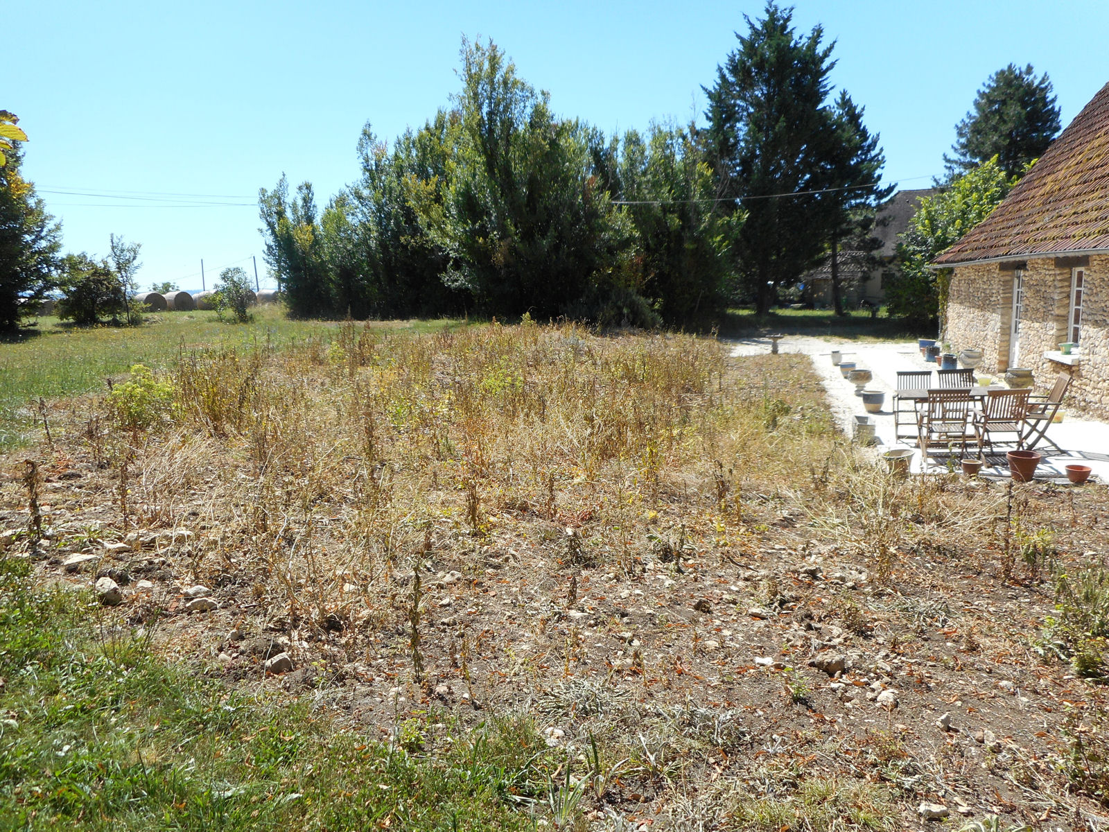
Not that it looked that way when I initially turned up at Malbec, because here’s the view that greeted me.

The airfield was enveloped in thick mist, which was actually the base of a low layer of cloud that I’d climbed up into on my way to the airfield. I’d checked the Égletons web cam and over there they were CAVOK, but there was no way that I could take off in the conditions that prevailed at Malbec at that moment.
So I set to to fix up my video recording arrangement and once that was done, all I could do was sit it out until the mist burnt off. My plan was to connect my little sportscam video recorder to one of the power packs that I now have to give me a much longer extended recording period that theoretically today would include the whole of the flight. I tested the arrangement out a few days ago and the sportscam recorded for 5½ hours, so as today’s flight was only planned to last for between 2 and 3 hours, there should have been ample time to record everything even if I forgot to switch it off after landing at each destination airfield.
But these little devices are determined to defy me and not do what I want them to. What actually happened was that the sportscam switched itself off almost immediately at Malbec, so I got nothing of the flight between Malbec and Égletons. However, it stayed on after I’d switched it back on again at Égletons and I got the whole flight from there to Aurillac, so that was one good thing.
However, it let me down again for the legs between Aurillac and Figeac and Figeac and Malbec, of which again I got absolutely nothing. I obviously need to find out why because the system clearly has the potential to do what I want it to. All I have to do is find out why sometimes it switches itself off again as soon as I start it up.
But at least I have the whole flight between Égletons and Aurillac on disk, which I’ll edit over the next few days and put up in the videos section.
Here are a couple of shots of the sportscam mounted under the wing with one of the new mounts that I recently bought (the original was too flimsy and snapped a while back) and the power pack strapped to the strut next to it with its power cable disconnected.


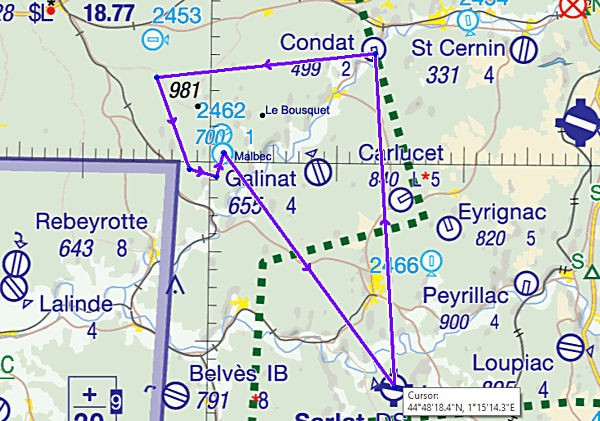
Part 1 – Malbec (Dordogne) to Égletons (Corrèze)
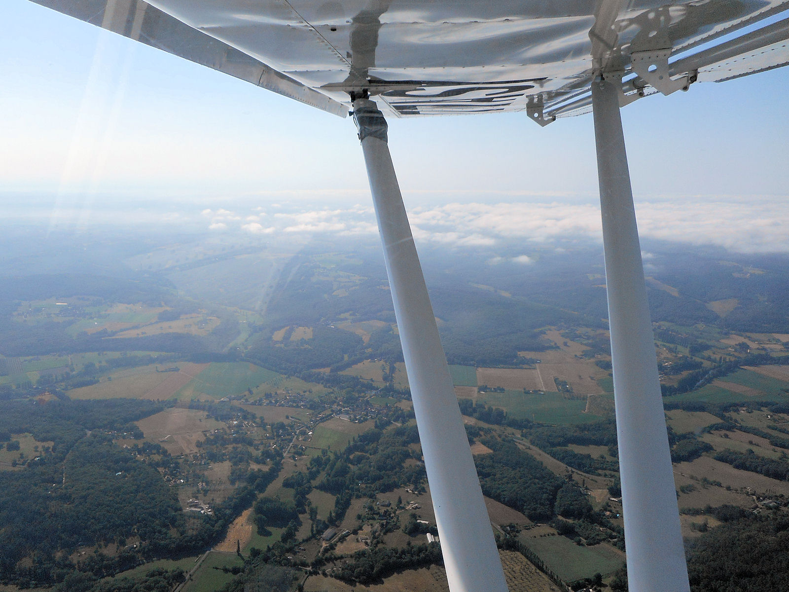
I took the next shot while I was still climbing out of Malbec on my north-easterly heading for Égletons. It shows a bit of the low cloud cover that had affected Malbec that I was leaving behind me, as it was burning off and breaking up.

The next shot is of my panel as I was on track just north-east of Montignac.

Here’s a shot that I took as I flew past the airfield at Condat that I’ve flown into a couple of times lately.

Now a shot of the old, closed Brive la Roche airport. It’ll be a wonder if stays intact for much longer, as close as it is to the city. In the UK it would already have been dug up for housing or industrial use.

As I continued into the Corrèze, the ground gradually began to rise up towards me. I also noticed that there were several large, deep clefts in the ground, one of which can be seen coming up in the next pic.

This is a shot I took of it as I flew past.

Nevertheless, despite beginning to rise up, the ground was on the whole a bit flatter than what I’d left behind in the Dordogne. However, as I approached the higher ground with its associated light cumulus cloud cover, the rising air was becoming noticeably more turbulent.

I had no problem spotting Égletons and as there was little or no wind, I elected to join downwind for runway 07. The landing went without incident and it was only as I was taxying to the runway exit, that an aircraft flew over me, going around in the opposite direction.
The couple shown in the next shot were aboard it and after they’d landed I apologised to them, as for some reason I’d not heard their calls and they, mine. This is something I’ll have to investigate as I also had radio problems at Aurillac, so I think I’m going to have to look closely at 77ASY’s aerial and power supply in the first instance to see if I can find anything.
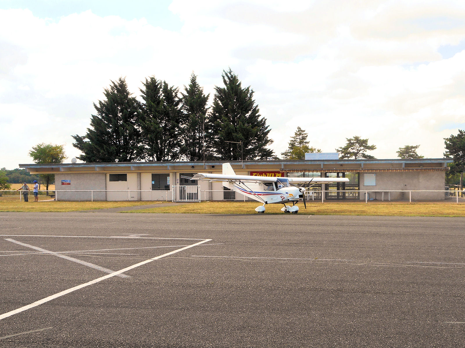
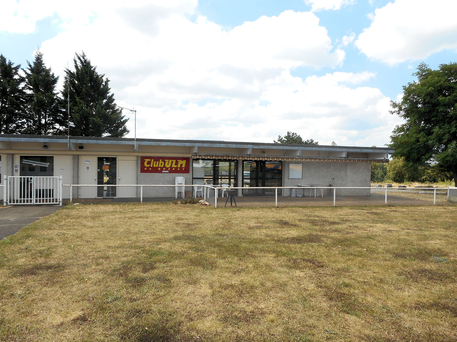
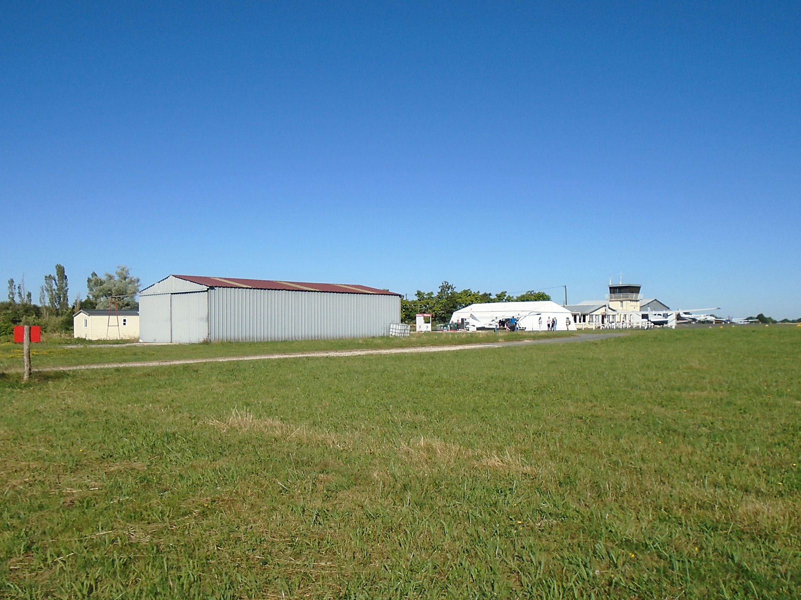
The final two shots in this section are of the aero club building (far right in the next shot) and hangars at Égletons.


Flight time Malbec to Égletons, 55 minutes.
Part 2 – Égletons (Corrèze) to Aurillac (Auvergne)
After a brief stop and short conversation with a group of aero club members outside one of the hangars, I took off from Égletons on runway 25 and climbed right to set course for Aurillac overhead the field. It’s gratifying that the Savannah climbs so effortlessly and soon gets you to the height that you want to be at without wasting any time at all.
As I headed south, the cloud cover over what is actually fairly high ground was playing all sorts of tricks and occasionally the level of turbulence was quite severe. But I refused to allow that to stop me taking pictures as the terrain I was flying over was unmissable.


As I flew on south, the deep clefts in the ground that I’d noticed further north became more and more pronounced until they were so large that they were filled with large expanses of water.
What you can see in the next shot is a single track railway line emerging from a tunnel in one hill, passing over an amazing elevated viaduct and then entering another on its other side.


I don’t know whether these were parts of a large winding river or lakes, but the landscape was both impressive and beautiful and I found it very reminiscent of the Swiss and Italian lakes.


Soon the long black ribbon of Aurillac’s tarmac runway hove into view and although there was not supposed to be an ATS (airfield traffic service) at that time of the day on a Sunday, I called up and was surprised to get a reply. The controller complained about the quality of my radio, understandably so as I could hear music from a public radio transmitter breaking through even into my headset.
Nevertheless, we made ourselves understood and I joined overhead to land on runway 33. Aurillac is open to commercial airlines and I wasn’t surprised to find when I taxied to the apron that a Hop ATR turboprop was parked and coned off there, probably ready for Monday’s flight to Paris. But then my ‘problems’ started.
Despite the official airfield card showing parking on the grass to the left of the terminal building, and there being a light aircraft tied down there, the controller didn’t like it when I taxied on there and told me to shut down my engine. He then came out onto the tower balcony and shouted down to me that taxying on the grass was prohibited, so to please him I moved 77ASY by hand.
After taking a few shots of the airfield, I requested permission to start up and taxy but he said, although I didn’t understand at the time, that I needed to move the aircraft manually. However, as he wasn’t supposed to be on duty, and didn’t respond to any further calls, including my request to enter the active runway and backtrack for take off, I just started up and taxied across the grass anyway without incident.
Naughty! There’ll probably be a letter in the post next week. In hind-sight, I should have moved 77ASY off the grass and onto the taxiway manually and then proceeded, but too late now to cry over spilt milk!
Here are the shots that I took at Aurillac. As I say, despite being a local commercial hub, the airport was otherwise totally dead, except for a flying school Savannah S that landed and taxied to the hangars while I was there.


Flight time Égletons to Aurillac, 40 minutes.
Part 3 – Aurillac (Auvergne) to Figeac (Lot)
The controller at Aurillac wasn’t responding to any radio calls by the time I wanted to take off as according to the officially published times, he wasn’t actually supposed to be on duty at all. But as the airport was so dead, I had no problem with announcing my intentions at every stage, taxying to the holding point and back-tracking runway 33 for take off.
In fact, because the runway is so long, eventually I couldn’t be bothered taxying any further and called that I was going to line up half-way down for a short take off. After doing that, I had reached my planned altitude, corresponding to the circuit height at Aurillac, well before the upwind end of the runway, so I then just turned on course and called up to say I was leaving the zone.
This leg of the flight represented a descent from the higher ground of the Auvergne to the lower ground of the Lot and the change in the terrain’s appearance reflected that. But it was still stunning to look at for all that. Here’s shot taken out of the left side of the aircraft shortly after I’d turned on course.

Here are some shots looking out of the other side of the aircraft. I think that it’s amazing how quickly the transition from quite mountainous to relatively flat terrain happens.


By now the rising thermals were making 77ASY behave a bit like a bucking bronco, so as the land I was passing over became flatter and relatively more featureless, I stopped taking photographs. Eventually Figeac’s hard runway came into view and I called up to join left downwind for runway 29.
I could see a few aircraft that were parked on the aprons and outside the hangars but no other signs of life, and so proved to be the case when I landed, taxied up to the apron and parked. No, actually there were a couple of guys having a conversation over the fence outside the ULM club, but they paid no attention to me and eventually went their separate ways.
I was amazed that there was no one around on such a lovely day, but that seems to be the way of things at the moment. Maybe the conditions at that time of day were just too turbulent for most people. I ended up taking a few photographs of the place, taking a swig from the flask of cold drink that I’d taken with me and heading off back to runway 29 for the final leg of my flight back to Malbec.
These are the shots that I took at Figeac while I was there.


Flying time from Aurillac to Figeac 35 minutes.
Part 4 – Figeac (Lot) to Malbec (Dordogne)
I more or less took off and flew straight out from Figeac to be on track for my final leg back to Malbec. There was no need to climb to any great altitude so I stayed at around 1800 feet at which level the turbulence from rising thermals had become quite uncomfortable.
This meant that taking photographs was the least of my priorities, but it didn’t matter as soon after the terrain that I was passing over began to transform itself into the typical Dordogne scenery that I’m now so accustomed to.


I knew that I was getting close to home when the village of Payrac passed under my port wing.

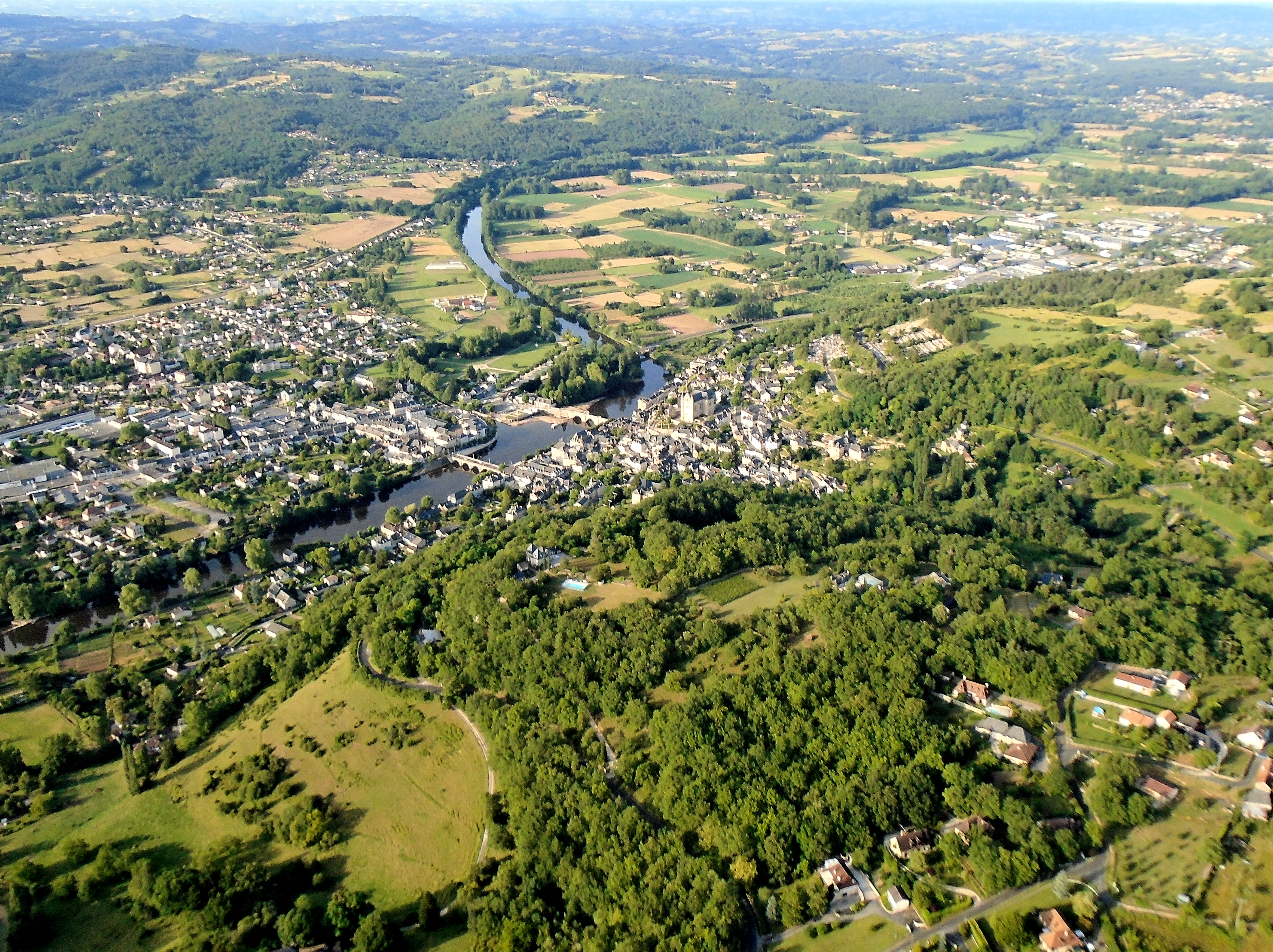
And then the great Dordogne river itself, which gives its name to this magnificent region of France.

I’d nearly reached journey’s end when I could see the airfield of Sarlat-Domme in the distance off to my left, confirmed when I flew abeam the town of Sarlat itself.

Then it was time to prepare for my landing back at Malbec. I spotted the airfield in good time and set myself up, as I like to do, for a comfortable long final. My efforts were rewarded with a text-book short field landing as I plonked 77ASY down and still had to apply power to reach the top of the runway.
So I’d finally reached journey’s end and successfully completed my flight covering four French Départements (Dordogne, Corrèze, Auvergne and the Lot) in a day. And what an amazing experience it had been.
Flying time Figeac to Malbec, 40 minutes.
Total flying time 2 hours 55 minutes.
Wim and I did a tour of the west coast last year but we don’t have anything similar planned for this year and we’re unlikely to now that the performances of our aircraft are so different. So I decided that instead I’d do a few longer one or two-day tours by myself, this being the first. And now I can’t wait for the next one 😉