


It’s just over 10 years since my friend Wim and I made our epic flight up the west coast of France over 6 days in June 2015, Wim in his red Weedhopper which he’d named The Red Baron and me in my yellow X-Air 56NE. I’ve been thinking about commemorating it, not by doing it again because I doubt that either of us would want to repeat the experience, and I’m not sure it would be possible to anyway after all these years with the increase in controlled airspace in that part of France and certainly not without transponders. Well, sort of doing it again, but this time in Microsoft Flight Simulator.
The program has come on so far with the latest version MSFS 2024 that visually it has come as close to real life as is currently possible, which is incredibly close on high end computer set ups. Even on my mid-range machine it’s highly immersive when ‘flown’ in virtual reality wearing a VR headset and the degree of realism is very high, so I’ve been thinking about repeating the flight on my computer. There are a couple of problems though. I don’t have either a red Weedhopper or a yellow X-Air in my flight sim but I do have a red and yellow MW6 which in style and performance are very close to the real aircraft we flew, so they will do in any imagery I create along the way.
Also, most of the airfields that we landed at do not exist in the flight sim. Most of them do visually, although only as very rough strips in the grass at best with buildings that look nothing like what actually exist, because the flight sim software uses Google Earth to create the terrain over which you fly. It is amazingly accurate when viewed from the air but not so much at ground level unless software developers have taken the trouble to design accurate airfield sceneries.
I’ve done that for the local airfields in the area around where I live and in which I fly – Chateau Malbec, Wim’s old airfield at Plazac, Philippe’s airfield at Mauzens and the airfields at Condat, Galinat and Figeac, but the only two sceneries that I can find of airfields at which we landed during our west coast flight are for Montpezat in the Lot et Garonne (stop-over on day 1) and St Brevin les Pins at the mouth of the River Loire (destination day 4).
For the flightsim experience to be worthwhile the airfields at which you take off and land have to be at least fairly close visually to the real thing, not for third parties who will most likely never have visited or even seen them, but for you the pilot at whom, after all, the experience is aimed. So I started by making some rough sceneries of the ones for which there are no detailed sceneries available ie most of them, and they would have done for as far as it goes. But that wasn’t really enough, not sufficiently immersive, so I’ve begun to make ones that are more accurate based on photographs etc that I took and will do so until I either get to the point that I’m happy with the result or fed up with the work.
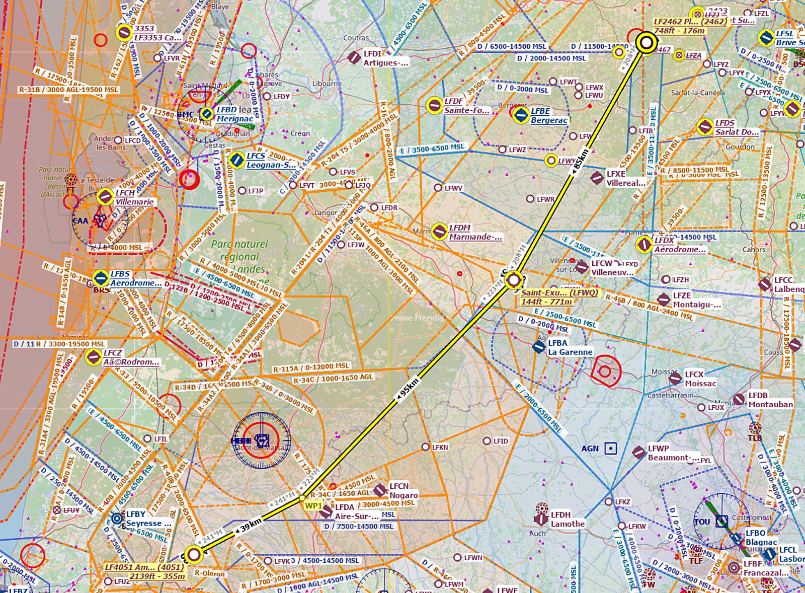
For the most part, in flight sim scenery design terms, the work is not too difficult because the airfields were mainly fairly sparse with just a hangar or so, a windsock and the markings for a runway. So the overall task is not too great and I’ve been working my way through it before starting on the flight itself, which will be all the more satisfying for the effort involved. I’ve also recreated the actual route that we took in the flight sim’s flight planning software from beginning to end, so it’ll be fairly easy to retrace our route in the flight sim. Here’s the route that we took on day 1 from Wim’s airfield at Plazac to Amou in the Landes with a stop-over at Montpezat.
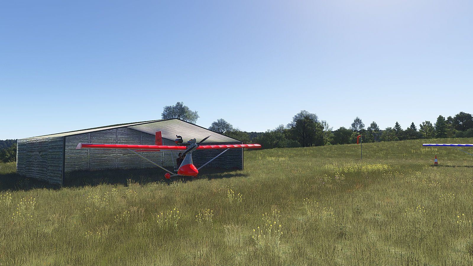
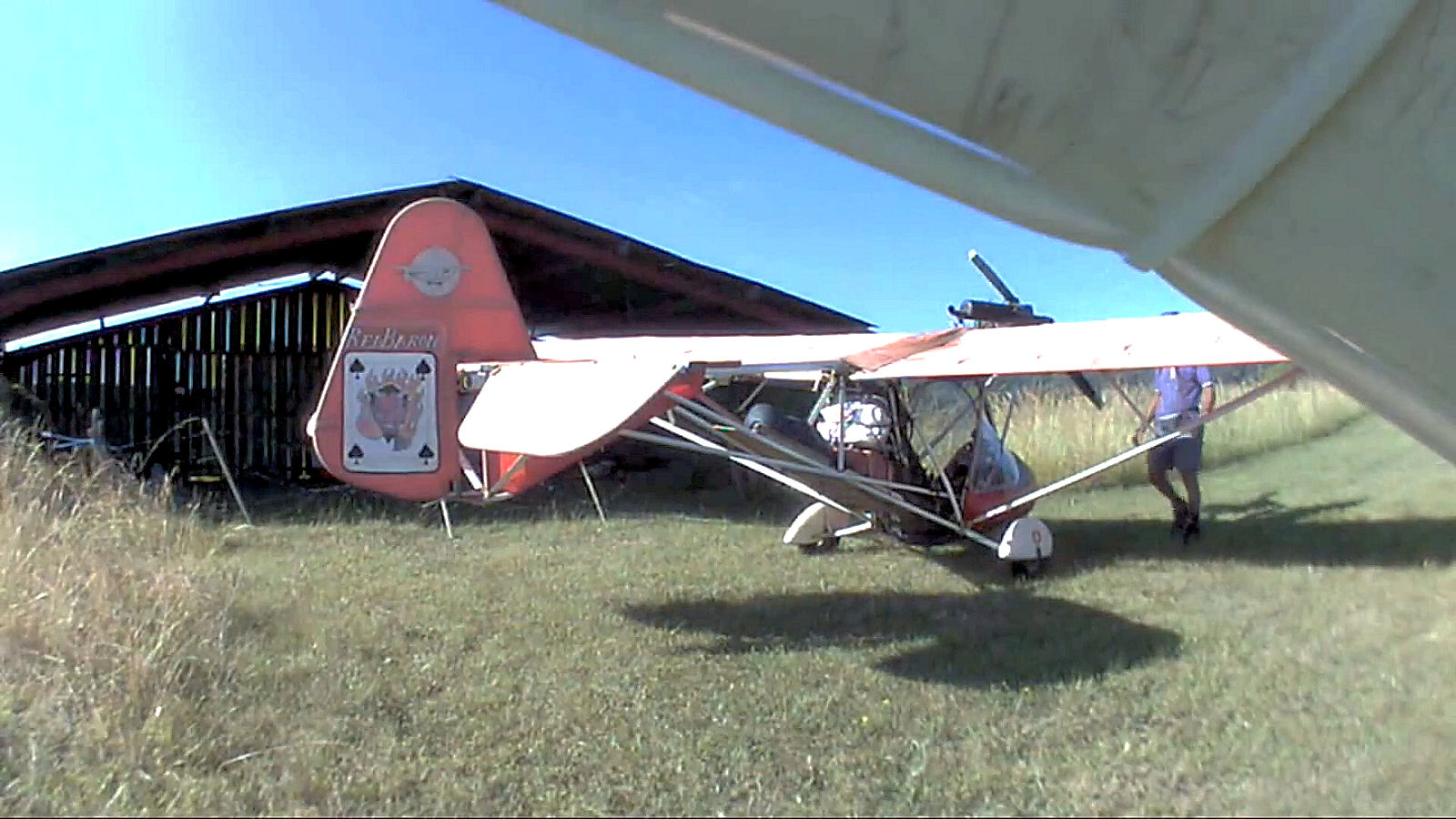
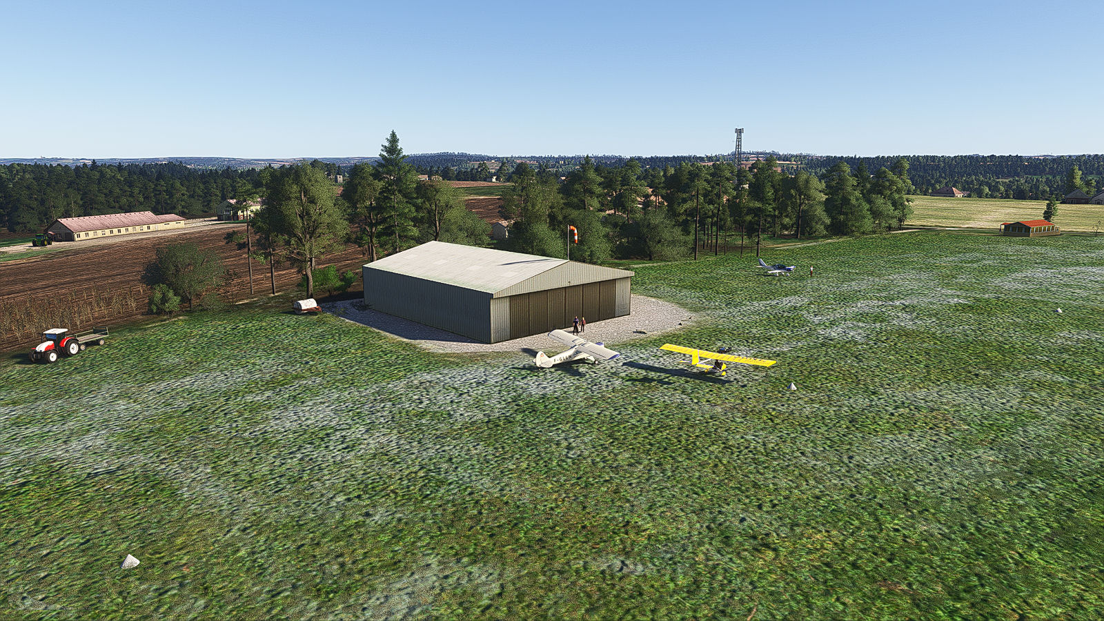
Now a couple of shots at Wim’s airfield,the first taken in my flight sim scenery of Wim’s airfield and the second lifted from a video shot on the actual day of the flight from under the wing of my X-Air, which is why the quality is somewhat poor.
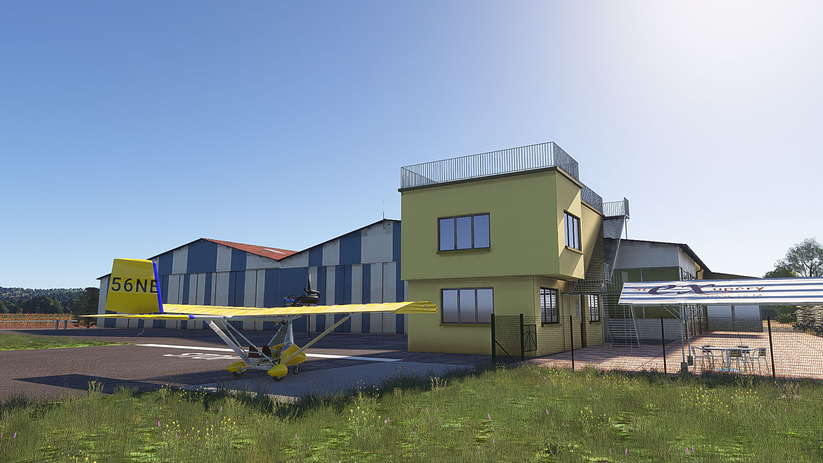
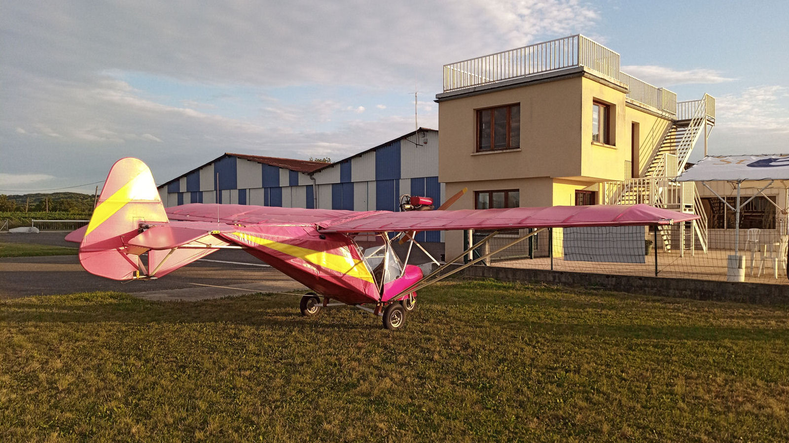
As mentioned earlier, we stopped over at Montpezat and here are two more shots, the first in the flight sim of the MW6 I’ll be using for the flight and the second of my old Weedhopper 28AAD actually in front of the control tower. The flight sim scenery designer (not me) did a very good job.
And as previously mentioned, we stopped overnight on day 1 in our tents at Amou in the Landes. As I recall, we had the only rain of the whole trip overnight and the next morning and we also had a disturbed night’s sleep because of night exercises by jets from the nearby armée de l’air airbase at Mont-de-Marsan.
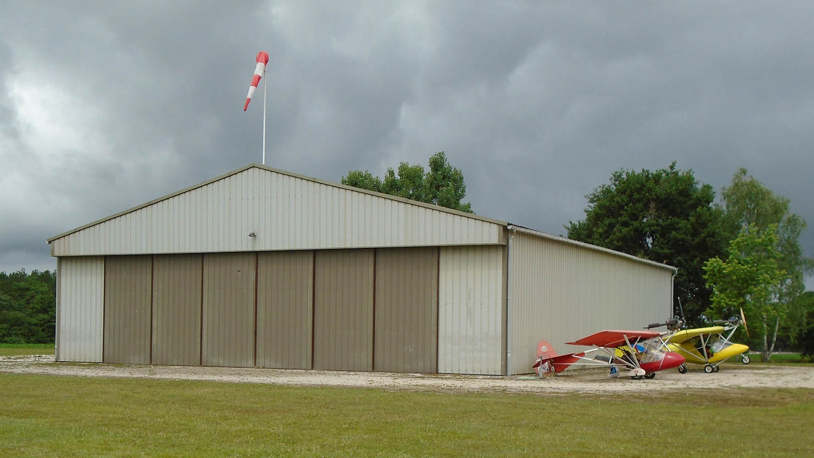
The final two shots are of my Amou scenery in the flight sim and of the hangar at Amou taken during the actual flight.
I don’t know exactly when I’ll be doing the flight in MSFS 2024. It’ll be when I’m happy with the airfield sceneries that I’ve created. It’ll probably also be over the course of 6 or more days, just like in the actual flight, but when I do do it I’ll be posting stuff on here, just as I did 10 years ago.